The Rio Grande del Norte National Monument - Wild Rivers
Author - Chad Belvill - REALTOR - Associate Broker at Dreamcatcher Real Estate Co. Inc - 100% Human authorship
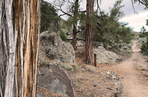
The Rio Grande del Norte National Monument - an enormous piece of land - 242,555 acres - designated by then-President Barack Obama in 2013- stretches from the Colorado border in the north to the tiny village of Pilar, NM, south of Taos. Covering the immense Taos Plateau, wrinkled as it is and covered in sagebrush, Piñon and Juniper forests and dotted with the remnants of ancient shield volcanoes, lava domes, and cinder cones, and incised by the ominous gorge cut through the ancient lava by the monument's namesake, it is a favorite nearby destination for hikers, bikers, hunters, fishermen, and explorers of all shapes and sizes.
While most recreation is fee-free in the monument, the Wild Rivers unit outside of Questa does carry a $3 per vehicle day use fee. The unit does have some of the best-managed public land resources in the area, with ample water supplies and clean vault toilets, in addition to camping and picnic areas both on the rim and deep below in the heart of the gorge. If you spend more than 6 days recreating here a year, go ahead and grab a season pass for $20. Camping on the rim - no electric hookups available - runs a staggering $7 per night, while backcountry camping in the inner sanctum of the gorge is $5. For up-to-date info straight from the horse's mouth - check out the BLM website.

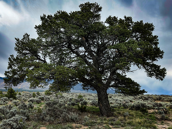
Yesterday, I had trouble deciding what to do, but I knew I needed to get out and move. The weather was far too nice, and while the aspens are putting on their annual show, I had not been down to the bottom of the gorge at all this year.
I spun north out of town and made the quick drive to Questa before making the left turn at the sign directing traffic towards the unit. Passing through the small village of Cerro - which translates to "hill" in Spanish, no doubt named after the volcanic cone known in modern times as Guadalupe Mountain - you'll quickly cross a cattle guard with a sign welcoming you to the monument.
The road - as well paved as a road can be, with ongoing construction continuing to improve the resource - twists and turns near the edge of the gorge for several miles, providing scenic views of the surrounding country, before turning into a clockwise directional one way lollipop shaped loop.
Passing the visitors center, you'll soon come to the first campground, El Aguaje. The road now starts making a sharp turn back to the north, with La Junta shelter and an overlook of the confluence of the Red River and Rio Grande at the apex. The popular La Junta trail is unfortunately closed due to its dangerous and deteriorating conditions.
Then three more campgrounds and day-use areas stack up in quick succession - Montoso, Little Arsenic, and Big Arsenic - the latter two named after freshwater springs below them at the bottom of the gorge.
This entire loop is linked by the Rinconada Trail, a gentle, well-maintained, all-ages multi-use trail. Users can hop on and off the trail at any of the developed areas on the loop with easy access to water, shelter, and toilet facilities. It's about 5.5 miles total and is great for beginner mountain bikers to start building skills, fitness, and confidence.


My plan was to park at the hikers lot at Big Arsenic Trail, run south on the Rinconada Trail the .9 miles to Little Arsenic, descend the 800 vertical feet down into the gorge, run back north along the river trail and then make the 800 foot climb back up to my truck on Big Arsenic.
I filled my water bladder with a couple of liters of water, added two electrolyte packs, stuffed a couple KIND bars and a ProMeal bar into my running vest, shoved an extra layer in the back for prudence's sake, started my watch and my playlist, and headed out.
Rinconada Trail is really nice. Like, the nicest trail around and aside from the West Rim Trail at the Rio Grande Gorge Bridge rest area northwest of Taos on US 64, the flattest trail around. If memory serves me, there is a little over 100 feet of elevation change in the entire loop. It may as well be a pancake.
But Big and Little Arsenic? They're nice, oh, to be sure they're amazing trails leading to an amazing place with incredible geology all around, but flat? No. Smooth? Well, there are a couple straight and sandy parts on the bottom. But these trails, like most trails in northern New Mexico, are steep and technical.

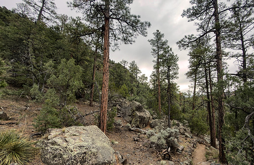
Little Arsenic - and Big for that matter if you go down rather than up - are a practice of foot-eye coordination while falling in a controlled fashion.
Then the trail plummets nearly 750 feet down in just .9 miles.
It winds steadily down through the piñon pines, sage, yucca, prickly pear cactus, and, depending on the time of year and rain, a host of other wildflowers like Pasque flowers and Sego Lilies. A band of Ponderosa Pine lies about midway down in one of the flatter areas - remnants and ancient river beds the Rio Grande left behind as it carved its way towards the center of the earth.
At the bottom, you'll hit the river trail, which stretches from the bottom of the Cebolla Mesa trail (a real favorite of mine that I'll do a write-up on at some point) about 1.75 miles to the south and another 2+ miles to the north - my direction today - to Big Arsenic Springs and slightly beyond.
This lower trail meanders up and down small climbs and drops with the river below you, and is easily accessible in most places with a little scrambling. Fishing for giant, wild, rainbow, cutbow, and brown trout is a popular yet crowd-free activity down here.
I was stopping regularly to snap photos but moved briskly upriver, enjoying the cool temps but wishing the clouds would break and for the sun to come out.
The Big Arsenic trail junction is before the springs and it's easy to miss so keep you eyes open if you arent wanting to go that far. It's maybe .3 or .4 miles further north and is well worth the visit if you've never seen it - a large pool of freshwater pouring out of the basalt at the base of a large boulder field. It's really an amazing place - be sure to practice Leave No Trace please.


I skipped the springs today and made the pull back uphill to my truck waiting for me above.
From the junction, it's just .6 miles up and only 450 feet of climbing due to the terrain below. Be certain that if you make it to the springs and the river, it will be close to 800 feet back up. But from the junction of Big Arsenic Trail and the river trail, it's only about 450 feet.
I made quick work of it, even while stopping to take in the epic views all around.
All told, the loop was 3.6 miles with 891 feet of elevation gain, and it took me 55 minutes of moving time, although it was almost 2 hours total time on my feet. I would plan on double that your first time down at the least, to allow time for side trips, explorations, and relaxation. It's certainly easy to spend the entire day down here, and the springs provide a source of fresh water (filter or chemically purify).
For overnight camping, there are shelters with fire rings, pit toilets (bring your own paper) and tent sites clustered at the bottom of La Junta, Little Arsenic, and Big Arsenic Springs.
Again, please Leave No Trace. Pack it out and be sure to check local fire restrictions before lighting up.

If you're thinking about moving to the area and you want to talk about lifestyle and location, don't hesitate to give me a call.
Or if you're just curious about the local
real estate market, check out my weekly reports at
www.realestateintaos.com for up-to-date market conditions for Taos and northern New Mexico.
Let’s talk
Chad Belvill
Associate Broker
&
Property Management
Dreamcatcher Real Estate Co. Inc
515 Gusdorf Rd. Suite 6 Taos, NM 87571
575-758-3606 o